Sunday, February 16, 2025 1:52PM

RALEIGH, N.C. (WTVD) — Buckle up! North Carolina weather is going to take us on a wild ride this week with a little bit of everything, starting Sunday.
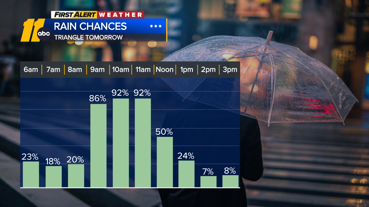
SUNDAY: There is a level one risk of severe storms for central North Carolina. Before 6 a.m., showers are most frequent near and southeast of I-95, but more radar blips are creeping into the Triangle.
ABC11 meteorologists estimate the biggest chance for damaging winds is between 9 a.m. and noon. There is a chance of an isolated tornado, but is very unlikely.
Severe thunderstorm warnings were issued for several counties in the central parts of the state. A high wind warning has been issued for the Triangle.
Rain tapers off Sunday afternoon and temperatures drop.
 Sunday Rain, Feb.15, 2025 (ABC11)
Look Ahead
Back to a chilly day for President’s Day on Monday.
The ABC11 Weather Team is still watching data as a system develops near Colorado late Sunday into Monday, which will help fine-tune the details of this system.

WEDNESDAY: Some wintry precipitation could develop Wednesday into Wednesday night across parts of central NC. As things stand right now the highest likelihood would be more of sleet and freezing rain mix rather than snow to our region.
THURSDAY: Cold but drying out.
FRIDAY: Temperatures in the teens and low 20s!
SEE ALSO | Here’s how to report and check power outages in your area
SEE ALSO | How to keep food safe during a power outage
SEE ALSO | Hacks to keep your phone, other electronic devices charged during a power outage
Copyright © 2025 WTVD-TV. All Rights Reserved.
