TOLEDO, Ohio — Hi there, I’m WTOL 11 Chief Meteorologist Chris Vickers.
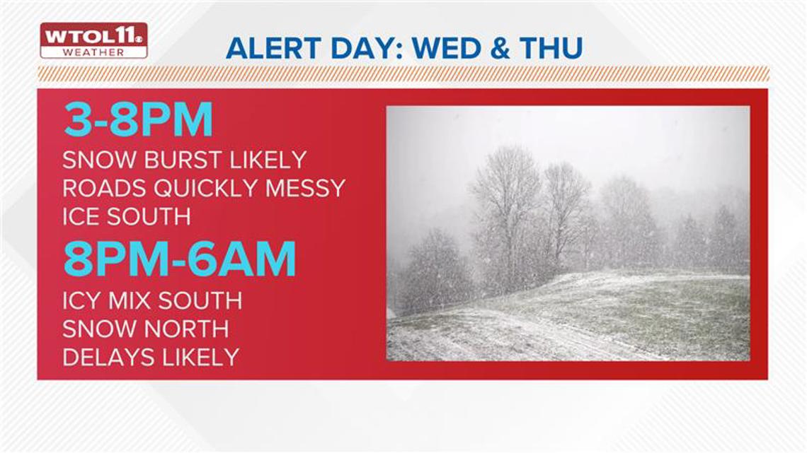
With the breakdown of a messy wintry storm that’s going to come into the area on Wednesday, the start of our next Weather Impact Alert Day, we may experience the full spectrum of winter weather — from snow to sleet to freezing rain to just plain old cold rain.
More likely, it will be all in the form of snow west and north of Toledo, and we’ll see that switch over from the Toledo metro south and to the east. This is why it’s a very close call because just to our north and west, this could be a major winter storm, and I’m talking easily 6 inches or more.

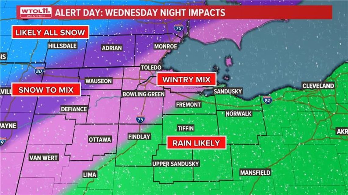
So, let’s time it out for our area, Northwest Ohio and Southeast Michigan. We’ll start dry on Wednesday morning, but snow, sleet, and freezing rain will work in between 3 to 5 p.m. It may come down quickly and heavily, but watch for that transition, especially south and east of the metro, to sleet and freezing rain and eventually some cold plain old rain will be possible.

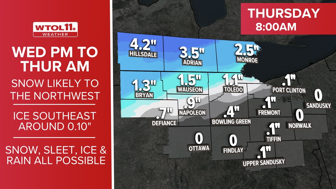
How much ice? We could get up to about 1/10 of an inch of ice accumulation. Again, very slippery conditions are expected, and the snow would be greatest north up in Michigan and far west of Toledo.
Stay safe and stay tuned during on air broadcasts, streaming on WTOL 11 Plus and on the WTOL 11 weather and news apps for more updates as we track this storm.