LINCOLN, Neb. (KOLN) – If you have any travel plans early on Saturday, you may want to consider waiting until the afternoon. Freezing rain accumulation is possible while snow and blowing snow are likely.
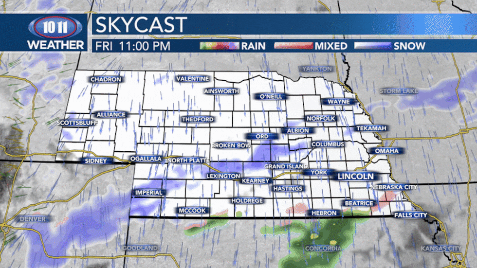
Wintry mix and snow early in the morning with activity tapering off in the afternoon.(KOLN)
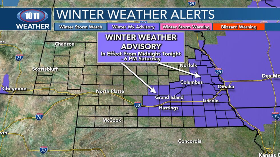
Winter weather advisories have already been issued for central and eastern Nebraska. Once again, ice, snow and blowing snow are all going to be concerns on roadways and sidewalks.
Ice accumulations possible and snowfall likely early Saturday with blowing snow during the day.(KOLN)
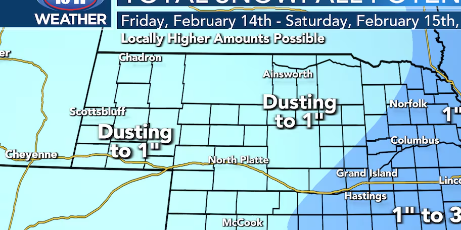
In terms of how much snow we could see, 1 to 3″ seems fairly likely as of Friday afternoon. There could be a heavier narrow band that sets up somewhere across the region, but most likely in northeast Nebraska as well and if so totals could exceed 4″.
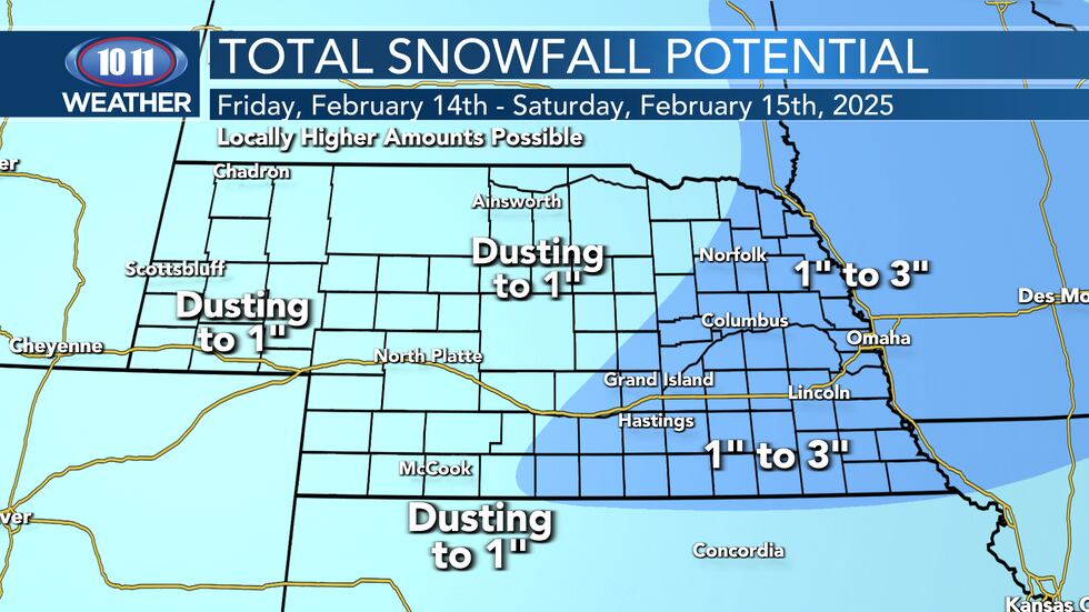
Dusting to 3″ possible early Saturday morning.(KOLN)
Highs are expected early in the day with steady/falling temperatures by the afternoon into the teens and 20s.
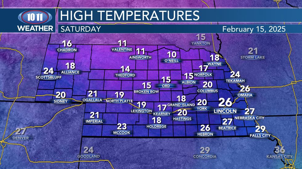
Teens and 20s early in the day with falling temperatures in the afternoon.(KOLN)
As we head into Sunday we dry out and cool down and we will keep cooling down into next week with a multitude of weather alert days. Record breaking cold continues to be in play heading into Wednesday and Thursday morning.
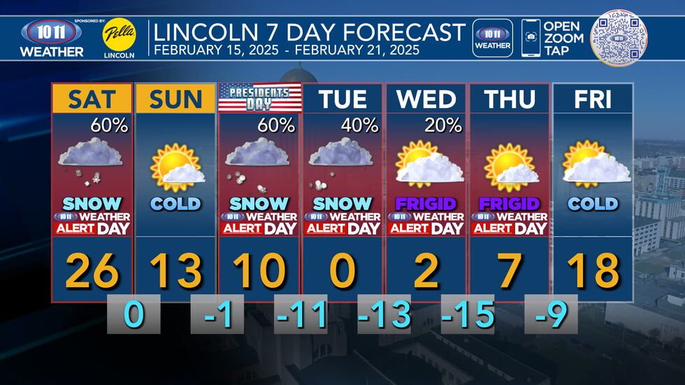
Dangerously cold conditions next week.(KOLN)
Click here to subscribe to our 10/11 NOW daily digest and breaking news alerts delivered straight to your email inbox.
Copyright 2025 KOLN. All rights reserved.